
Out of all the adventures I have undertaken, paddling the Yukon River has undoubtedly been the most fun, capturing my heart and restoring my spirits so rapturously that I dream of it still, wishing that I could experience it again for the first time. It’s storybook perfect, checking all the boxes: relatively beginner friendly; not too long, not too short–ideal for a summer getaway; breathtaking scenery; vast stretches of remote wilderness, yet towns spaced close enough together for plenty of chances for human connection too; challenging enough to be rewarding while easy enough to be relaxing. And, perhaps most incredibly, hardly anyone seems to know about it, for so few venture out every year. It’s a heaven all your own. I could not recommend it more adamantly. If someone told me they had just hiked the Appalachian Trail, or done a cross-country bicycle tour, and were looking for their next big adventure, I would leap at the opportunity to steer them towards the Yukon River. It’s why I’m writing this free guide, such a labor of love, as none exist like it on the internet. So whether you’ve already committed to thru-paddling this extraordinary river or have only just begun to foster the dream, I hope this comprehensive guide can make the journey feel a little more possible for you.
Now, a necessary disclaimer: this guide is not strictly factual, it includes my personal experiences, opinions, and biases throughout. River conditions change yearly. Do your own due diligence; your safety is your responsibility.
Mileage Map
This map records each mile of the river for easy navigational reference on your GPS. It lists every town along the way as well as major hazards, potential campsites, and points of interest. Feel free to download the kml/kmz file.
My map is not an accurate representation of river miles and should not be considered gospel. Why? Because such a thing is so hard to get right. After all, the official start of the Yukon is contested, and with so many different channels in the river, determining the main channel by which to record mileage from is difficult. Consider the listed mileage my best approximation. Similarly, while I attempted to have my map indicate the “correct” path through the maze of islands and sloughs along the river, there are absolutely inconsistencies. Many. The path shown from Whitehorse to Dawson City was copied in part from Mike Rourke’s printed field maps to be the most precise. The Flats were purely guesswork on my part and are inherently flawed. My path also hugs the right bank in the Run to the Delta and cuts through a few shortcuts, such as the Tunurokpak Channel.
The Ultimate Guidebook

 Paddling the Yukon River and its Tributaries by Dan Maclean
… is the best source for information out there! I highly recommend it. After 20 years, it remains as informative as the day it was published in 2005. There are only a few outdated details within the book that I’ll address later.
It can be purchased from Amazon or read for free on Everand with a 30-day trial of their services.
One of the greatest things about this book is its descriptive list of every major point along the river. See an example section here. I referred back to this list numerous times during my own trip.
Q & A
Table of Contents
1. Who is the river suitable for? Is it beginner friendly?
2. How long does it take to paddle?
3. When is the best time to go?
4. Should you have a kayak or canoe?
5. Where do you purchase your gear?
6. How many paddlers attempt the river annually?
7. What is the most popular section of the river?
8. What do you think the best section of the river is? The worst?
9. Where are the most up-to-date maps found?
10. How do you get to the start?
11. How do you leave at the finish?
12. What is the weather like?
13. What is the water like? Can it be swam in?
14. What is the wind like?
15. What kind of wildlife frequent the river?
16. What are the villages and their inhabitants like along the way?
17. Where do you dock your boat in towns?
18. Where are road access points?
19. How much does it cost to thru-paddle?
20. How could you cut costs to make the trip more affordable?
21. What gear should you bring?
22. What clothes are necessary?
23. What kind of footwear is best?
24. How do you eat/resupply along the way?
25. How do you drink along the way?
26. How do you charge your electronics?
27. How do you shower/laundry?
28. Where do you camp?
29. Are there cabins along the river?
30. How do you manage waste disposal?
31. Where do you find service/WiFi along the river?
32. What are the major dangers?
33. Are there rapids? Other river hazards?
34. What safety precautions should you take?
35. How do you deal with grizzly bears?
36. Can you bring a firearm?
37. Can you fish along the river?
38. How bad are bugs along the river?
39. If you had a do over, what would you do differently?
40. Is it possible to keep your canoe or kayak at the end?
41. Are there other sources you recommend?
42. How can you connect with other paddlers?
Discrepancies Section Summaries Town Chart
________________________________
1. Who is the river suitable for? Is it beginner friendly?
The Yukon is calling to anyone in search of honest adventure, with a profound love of the backcountry, and the grit and determination to go the distance. Despite the fact that the Yukon River is the third longest river in North America, spanning the length of Alaska as it weaves through some of the most rugged wilderness in the world, it’s surprisingly beginner-friendly. Provided you keep your wits about you, exercise caution and common sense, and are certain that you enjoy extended camping trips.
To quote Dan Maclean–
“If you can point a boat in the direction you want to travel and then follow through on that path, you have the technical skills necessary to paddle any of these rivers … The water is mostly smooth and has more in common with a lake than with a river.”
“Hiking trips such as completing … [a thru hike] … provide an excellent background for long floats. They teach you the state of mind necessary to travel a set distance each day, food planning over long periods of time, and basic map reading. These skills are more likely to help you safely reach the delta than the ability to pirouette a boat through whitewater.”
2. How long does it take to paddle?
7-10 weeks on average.
2 months, essentially.
The Yukon is ~1980-2000 miles long when measuring from the source, the Llyeweyllyn Glacier on the southern end of Atlin Lake in British Columbia.
The Yukon is ~1800 miles long when measuring from the start of the river proper, where it diverges into its own distinct channel, at the northern end of Marsh Lake.
3. When is the best time to go?
Depart: Mid-May through early June, as soon as the main channel is clear of ice. This allows you to take advantage of the spring melt water, riding the swell swiftly downriver.
Finish: Early to mid August, as the month marks the onset of rainy season. The later you go, the more storms you’re hankering to meet.
4. Should you have a kayak or canoe?
This ultimately comes down to personal preference, as river conditions are equally favorable for both. Countless canoes and kayaks have successfully traversed the Yukon, making for no explicitly wrong answer.
If you haven’t sworn your allegiance already, chances are that you will come to find yourself innately drawn to one or another. The right choice will be the one that calls to you.
Practical considerations (which exemplify their contrasting pros and cons)–
Kayaks are faster and safer, handling wind and waves better. The trade-off is that they have limited storage space and compact cockpits which can make for more awkward entries and cramped seating. If chosen, opt for a kayak with a rudder and/or skeg.
Canoes boast superior carrying capacity, more spacious seating, are generally cheaper, and can function as a makeshift shelter in a pinch, but this comes at the expense of some speed and stability in rough surf. If chosen, opt for a canoe with a deep keel for tracking in the wind as opposed to a flat bottom.
My observations While preparing for the Yukon, I was so torn on which to choose — seriously, it haunted me up until my launch — that I would ask everyone within earshot from family to friends to total strangers: “which would you choose?” and I was surprised by how passionately people made their cases for each, lines drawn in the sand.
In the end, I fell for a kayak. I like to travel light, so less storage space never concerned me, and despite all the grumblings I had heard about the seating, I found mine remarkably comfortable, especially when compared to sitting on a horse or a bicycle as I am accustomed to. And travelling solo on a deadline, the greater speed and stability of a kayak felt crucial to me. I can’t count the number of times during rough surf that I thought with a laugh, “hey, at least I’m not in a canoe!” which, okay, okay, I know a lot of people are going to read that and want to throw stones at me. Because here’s the thing: many would swear on a canoe with the same conviction I have for a kayak, and they have every right to. Dan Maclean, who championed the best guidebook for the river, used a canoe on his voyage and sang its praise. Canoes vastly outnumber kayaks on the tourist-heavy stretch between Whitehorse and Dawson City, Canada, although kayaks are more popular for the long haul. The Germans are partial to canoes; the Japanese, kayaks.
5. Where do you purchase your gear?
Kanoe People and Up North Adventures are the two major outfitters in Whitehorse, Canada.
They come fully stocked with your paddling essentials: canoes, kayaks, paddles, paddle floats, paddle leashes, life jackets/PFDs, bilge pumps, sponges, spray skirts, dry bags, barrels, bear spray, fuel canisters, throw bags, maps, footwear, etc.
Unfortunately, you cannot sample their inventory online aside from the names of the brands they may have in stock. For specific questions, shoot them an email!
Yukon Wide Adventures is another outfitter, carrying more camping-specific gear. There is also a Walmart Supercenter in town with prices comparable to the lower 48.
If flying into Whitehorse, all your gear can be purchased in advance and brought as checked luggage aside from your choice of watercraft*, bear spray, fuel canisters and your spray skirt, if applicable, since the right size can only be determined after selecting a kayak. Canoe barrels may be simpler to buy on site too, unless you use them like a suitcase on your flight. (A cursory Google search suggests that this has been done before.)
Fuel canisters and bear spray are prohibited on all flights, domestic and international, and unfortunately no airline permits kayaks/canoes over 10 feet.
*The only workaround to this would be to bring an inflatable or collapsible canoe/kayak!
My observations Kanoe People sits right along the riverbank and is owned by a gentleman named Scott. Up North Adventures is within eyesight roughly 100 feet away and is owned by a gentleman named Mark. Both are welcoming and friendly and personally favor canoes–yes, I roped them into my “which would you choose?” debate! Ironically, their affinity for canoes had the opposite effect than I was anticipating: instead of driving me into the arms of a canoe, I still resisted, making it undeniable at last that my heart lie with a kayak! Neither men are intimately familiar with the river past Dawson City. I was disappointed by a lack of kayaks at Up North Adventures, with only 2 or 3 to choose from. (I’m sure their inventory fluctuates, this was simply the case at the time of my visit.) Kanoe People had a greater number of kayaks with most of their new ones of the “Delta” brand. Both shops had canoes aplenty, I recall seeing the most “Old Town” , “Clipper”, and “Nova Craft” models. I really liked that Up North Adventures carried the NRS brand, their selection of accessories was most excellent, and I purchased my PFD, bilge pump, paddle float, and paddle leash with them. They gifted me a it’s-so-ugly-it’s-cute bucket hat! Meanwhile, I got the remainder of my gear–my kayak, paddles, spray skirt, dry bags, etc.– at Kanoe People. (I was shocked to discover that neither store carried Dan Maclean’s book, at least from what I saw?) Scott at Kanoe People graciously let me leave my gear on site overnight in a storage shed so I wouldn’t have to haul it all to my motel. He also gave me sage advice throughout the purchase process, being incredibly patient and understanding of me as a beginner.
6. How many paddlers attempt the whole river annually?
Approximately 5 to 10 parties
*note-I’m only counting thru-paddlers here
The number is staggeringly low as of 2024. If you are looking for your own personal slice of heaven, a place so beautiful and pristine yet off everyone else’s radar, the Yukon is for YOU! Throughout my trip, it consistently felt as if I had the river to myself. I did not encounter a single paddler across the entire length of Alaska! This reality left me equal parts baffled and amazed.
From what I could piece together from locals: the river was frequented most between the 1970’s and early 2000’s, with dozens of paddling parties in a typical year. This surge might have been prompted in part by a National Geographic documentary on the Yukon? Numbers began to decline thereafter — shockingly, considering most national parks and long distance trails like the Appalachian Trail in the USA have experienced the opposite phenomenon, skyrocketing in popularity in the new millennia. The river then took a hit during the pandemic, temporarily preventing international travelers from visiting. Numbers have never rebounded since, meaning there has never been a better time to go!
Most paddlers are American, Canadian, or German. Germans make up the bulk of foreign travelers on the river by a large margin; they flock to it for reasons unknown to me. (A Jack London fetish? Kidding. Good advertising over there?) Neighboring European nationals or the Japanese would be second on the list.
My observations The day I departed from Whitehorse, I met a pair of retired German men in a canoe who were intending to go the distance, albeit at a leisurely pace. I would go on to cross paths with another 2-3 pairs of canoeists between Carmacks and Dawson City, all in rented canoes, signifying that their end point would be Dawson City. After that, I did not see another soul. Though I asked in every town about the whereabouts of other paddlers. On my radar was one group of 6-7 Europeans a week ahead of me who remained consistently out of reach. In the village of Galena, the 2/3rd’s mark, I met a man in a motorboat who had come from Whitehorse and asked him who might be on my tail, in it for the long haul, and his answer was no one.
But perhaps my experience was a fluke. I would anticipate crossing paths with anywhere from 1 to 10 parties intending to go the distance. Not to mention countless motor boats!
7. What is the most popular section of the river?
Whitehorse to Dawson City. Absolutely.
Hundreds traverse the Canadian section annually. The Yukon River Quest is an annual race between the two towns with the frontrunners paddling the distance in 2 to 3 days. The lesser known Yukon 1000, “the world’s longest paddle race,” stretches from Whitehorse to the Dalton Highway Bridge and has only a few participants every year. The frontrunners finish in 7-8 days.
The outfitters in Whitehorse offer both guided and self-guided tours along this stretch, complete with gear rental packages.
Conveniently, this is the only point on the river where a highway parallels its length, connecting towns by car and allowing for a shuttle to travel between the two major towns.
Paddling traffic steadily declines after Dawson City, nearly flat lining past the Dalton Highway Bridge.
If you want to avoid crowds between Whitehorse and Dawson City, leave as early as possible. Most casual paddlers, the tourists on 1 or 2 week trips, go in late June and July. This is when the Canadian portion of the river is teeming with people and designated campsites can get competitive. Or so I have heard, second hand. In mid to late May it’s blissfully quiet just like it always is further downstream, while the weather is still quite nice and the mosquitos and bear activity are low.
8. What do you think the best section of the river is? The worst?
My observations
The best: Whitehorse to Circle, with the 30 Mile River (Mile Marker 82-112) and Slaven’s Roadhouse (Mile Marker 669) being my favorite parts.
The worst: the Run to the Delta, though I am hesitant to admit this. While it’s true that this section is most likely to have the foulest weather, ranking it at the bottom, don’t make the same mistake I did and allow this possibility to haunt you! I found myself quietly dreading my final two weeks on the river, anxiously anticipating a deluge of thunderstorms, only to be blessed by fair weather more often than not and landscapes as lovely as ever. I am so glad I did the entire river and wouldn’t trade the experience for the world.
9. Where are the most up-to-date maps found?
I can attest to Garmin Explore, my GPS/mapping software of choice, being remarkably accurate. It represented every major island well with few inaccuracies, only missing a couple of sandbars which are in a constant state of flux.
The same is likely true of GAIA GPS and Google Maps though I can not confirm that. Google Maps does not list the names of the individual islands along the river to orient yourself by.
From Whitehorse to Dawson City, the best map book of the river is by Mike Rourke. It’s sold by every outfitter in Whitehorse. If space is a concern in your boat and you’re not a history buff, get the shortened version (only 57 pages versus 155 pages) if available which cuts out the filler text and gets right to the meat of it. The maps are at an approximate scale of 1:65,000 and identify geographical and historical sights, river impediments, and possible campsite locations. An example page is shown here.
Mike Rourke similarly has a map book covering Dawson City to Circle.
There are no map books published on the river downstream of Circle nor easy-to-find maps online to print. You might try the USGS Gov website. Or otherwise print photos from your GPS app of choice if you want physical copies.
My observations I used Garmin Explore to navigate by 99% of the time. The only physical maps I maintained were of the ones displayed in Dan Maclean’s book. I figured that there’s no way to truly to get lost on the river–every slough leads back to the main channel eventually–to require more physical backups. Though, admittedly, I did covertly snaps photos of every map page from Mike Rourke’s book at an outfitters shop in Whitehorse to have my own free digital copies of those. Before I was a river rat I was a street rat …
10. How do you get to the start?
The easiest way is to fly to Whitehorse, Canada, though this requires buying a canoe/kayak on site unless you bring an inflatable/collapsible model.
My observations My ticket from Charlotte, NC to Seattle, WA was $133 ($206 with checked baggage fees) and my ticket from Seattle, WA to Whitehorse, Canada with a short layover in Vancouver was $183 ($283 with checked baggage fees). I purchased my tickets 2-3 months in advance.
I slept at the Whitehorse airport my first night in town. There is a quiet waiting area with padded seats and outlets upstairs of the main terminal.
Up North Adventures and Kanoe People provide shuttle services to Marsh Lake for a fee if you wish to begin at the start of the Yukon River. The majority of paddlers opt to take off from Whitehorse, 28-29 miles downriver, for simplicity’s sake. This bypasses the only portage along the river at the Whitehorse dam.
Diehard purists get a lift to the base of Llewellyn Glacier at Atlin Lake which is considered to be the true source of the Yukon, albeit not the start of the river proper.
Robert Service Campground is 2.5 km / 1.5 ml from downtown Whitehorse and costs $36.75 CAD / $26.92 USD a night. It has coin-operated showers, bathrooms, potable water, fire pits, but no electricity.
There is one hostel called The Beez Kneez that costs $45 CAD / $33 USD + taxes for a bunk in a co-ed dorm.
The cheapest motel in town is the Best Value Inn conveniently located across from Kanoe People. I caved and stayed here my second night in town as the hostel was fully booked and I figured I’d treat myself to one last night of luxury before two months of tent camping. There’s plenty of other, classier hotels in town too.
If you drive to Whitehorse, you will have to find a place to store your car. Airport parking is limited to 30 days, a safe bet if you’re only paddling Whitehorse to Dawson City. For longer excursions, try inquiring on local online forums or calling the visitor center in town. Robert Service Campground may offer long-term parking for a fee (not verified).
11. How do you leave at the finish?
If you want to catch a ride from the Bering Sea back to Emmonak, call Kwik’Pak Fisheries to arrange transportation. (907) 949-1120. They are known for picking up paddlers. I was quoted $50 for the service, including to have me and my kayak delivered to the airport after.
Since Emmonak isn’t connected to the road system in Alaska, you will have no choice but to fly to Bethel with Grant Aviation to then catch a connection to Anchorage with Alaskan Airlines. It may be possible to hitch a ride on a boat back to St Mary’s and then fly out of their airport directly to Anchorage, but I’m not sure.
Grant Aviation is the worst. They know they have you under their thumb and charge an obscene rate of $365 for their hour long flight from Emmonak to Bethel. They use small engine planes that fits roughly 10-15 passengers, plus one pilot.
Bethel to Anchorage via Alaskan Airlines takes another hour of air time and is similarly a price gouge at $308. They use a standard full sized commercial airliner with TSA security here since Bethel serves as the “hub” for all air traffic in this part of the bush.
So to fly from Emmonak to Anchorage, a distance of 563 air miles, will set you back ~$673. You’ll likely spend less flying thousands of miles home from Anchorage!
My last minute ticket from Anchorage to Seattle was another $308.
Oof.
12. What is the weather like?
The Interior has a continental climate interspersed by brief, sudden storms. On the delta, it’s cooler and wetter with longer lasting storms. June to mid July is generally dry and sunny and absolutely sublime, with temperatures averaging from 60 to 80 degrees. It never gets completely dark at night, allowing for 24-hour paddling potential. Late July and August is typically the start of rainy season with temperatures dropping into the 40s or 50s, and finally the sun begins to set for 4-5 hours overnight. It’s generally chilly when it rains regardless of the month.
Incredibly, it often feels ~10-15 degrees warmer in the Yukon/Alaska than it does in the Lower 48 at the same temperature. This is because of the sun’s angle at the higher latitude.
My observations When I arrived in Whitehorse on May 30th, the forecast projected a week of 50-degree weather. A little chilly, I supposed. Imagine my surprise when I quickly discovered that 50-degree days actually feel more like 60-65 degree days, warm enough for short sleeves when the sun is shining!
13. What is the water like? Can it be swam in?
Normally, the water is frigid and cannot be swam in. Hypothermia is a serious risk if submerged. The water starts out crystal clear before becoming increasingly browner as silt is dispensed by tributaries along the way. At times, you can hear the silt rasping against the hull of your boat. The current is swift from Whitehorse to Fort Yukon where it then gradually slows. The main channel starts out narrow before expanding to a width of 1-2 miles by the end, more akin to a lake’s surface.
My observations There are exceptions to every rule. One day, I dipped my fingers into the river by Tanana, AK, and was stunned to find that the water was WARM! On two separate occasions, I saw local, native children happily swimming in the water. I imagine on the hottest of days it might be refreshing for anyone to, but not ordinarily. I also rarely ever heard the river’s silt rasping against the hull of my boat, though I’ve heard other paddlers speak of it being a common phenomenon.
14. What is the wind like?
Wind is the most prevalent danger on the river.
For those new to paddling, wind is what will whip otherwise calm, flat water into waves. A headwind will slow you down when paddling; a tail wind will speed you up. You always want to meet waves head on (as you would with a headwind) so the bow of your boat can slice through the wave–same goes for the wakes that motorboats/skiffs create. A crosswind has the greatest potential to capsize you since it hits broadside. Kayaks handle wind better than canoes.
Be aware: when the wind picks up, often the water doesn’t appear as rough as it really is in the middle of the channel when viewed from shore. Looks can be deceiving! The presence of whitecaps is a sure sign to stay clear.
-
- 0-5 mph winds are slight–you may hardly notice any difference in paddling speed, and the water may appear flat still
- 6-10 mph winds are moderate–you will begin to notice a difference in paddling speed, and the water may be choppy but manageable
- 11-14 mph winds are high– difficult to paddle in, you must now exercise considerable caution, whitecaps may be present
- 15+ mph winds are extreme–whitecaps are often present, stay off the river unless you are experienced and in a kayak
Wind is always the worst where the channel is widest. On the Run To The Delta (aka after Galena) is where the channel is 1 to 2 miles wide. Holy Cross to Emmonak can be particularly bad because the flat delta has less tree coverage. Be careful when crossing the main channel here, such as to enter Tunurokpak Channel or Kwiguk Pass.
my observations The worst conditions I ever faced on the Yukon were waves created by wind. Particularly, the day I got caught on an eddy line turning into Kwiguk Pass–I didn’t swing wide enough to avoid this nasty area–while there was a 16 mph crosswind. It was on this day that I learned first hand WHY eddies are considered so dangerous in high winds. ‘Cause suddenly the waves were coming at me from multiple directions at once so I couldn’t face them all head on. 🤣
15. What kind of wildlife frequent the river?
Grizzly bears, black bears, moose, wolves, beavers, deer, porcupines, red foxes, bald eagles, arctic terns, spotted sandpipers, ospreys, geese, ducks, grouse, seagulls, and salmon, to name the most common animals.
My observations When it comes to mammals, I saw the most moose -particularly cows with their calves in tow, claiming the inner islands as their birthing safe havens — and beavers, quick to cannonball into the water at the first sign of danger. In the air, bald eagles and seagulls reigned supreme. Bald eagles were greatest from Whitehorse to Dawson City, seagulls in the Flats, though both birds were present throughout. Spotted sandpipers and foxes didn’t make an appearance until the Run to The Delta. Porcupines made for the best surprise guests as they’d go waddling down the beaches, unfazed by my presence. I crossed paths with a dozen or so black bears. Disappointingly, grizzly bears eluded me, but their tracks were plentiful along the river banks. My most cherished wildlife encounter was with a lone wolf puppy.
16. What are the villages and their inhabitants like along the way?
In Canada, the majority of locals are of white European Canadian ancestry or indigenous. First Nations along the river include: the Kwanlin Dün (Whitehorse region), Little Salmon/Carmacks (Carmacks region), Selkirk (Fort Selkirk region), and Tr’ondëk Hwëch’in (Dawson City region). Whitehorse and Dawson City are tourist towns and welcome a small numbers of other minorities as well. In Alaska, most villagers are Native American, though there’s always a smattering of white people, too. Those of Athabascan descent comprise the bulk of the Interior population from Eagle to Russian Mission while those of Yu’pik descent inhabit the Delta region from Marshall to Emmonak. Athabascans resemble Native Americans from the lower 48, whereas the Yu’pik are closely related to Eskimos/Inuits, with distinct Asian influences reflected in their facial features.
Like anywhere in the world, most people are friendly, the towns welcoming.
Subsistence living is popular, so is government assisted living. Many towns are obscured from view by heavy tree coverage, and certain ones are “dry,” meaning alcohol is forbidden to be sold and/or possessed.
Native Alaskans have coined paddlers as “drifters,” so you may occasionally be called that. Though, in my experience, they tend to use the term rather sheepishly and lightheartedly in front of you.
My observations I was met with incredible hospitality and generosity in towns. Locals offered me rides in their vehicles or on the backs of 4-wheelers, gave me sightseeing tours, treated me to dinner (moose soup, twice!), let me stay in their private cabins along the river, and shared with me heartfelt advice, encouragement, and stories. The worst town I passed through was Marshall which had a beach littered with garbage, stray dogs everywhere, and more intoxicated adults stumbling around in broad daylight than not. No other town was remotely like this. Fort Yukon tends to be the butt of a lot of jokes up and down the river-the undertone being that they struggle with alcoholism- but I had a great experience there and met another traveler who echoed the same sentiment.
17. Where do you dock your boat in towns?
Every village along the river has at least one public boat dock/landing and, quite simply, it tends to be wherever you see the most boats grouped together.
Sometime this spot is obvious, other times it’s momentarily perplexing.
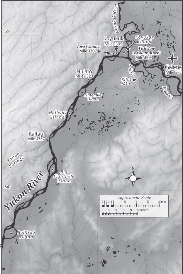
Many villages are on a bluff and/or obscured by trees so, upon approach, it’s always a good idea to hug the bank as tightly as possible so you’re only a few strokes from making land, especially if the current is strong. It’s possible to miss some towns entirely, particularly when they are located in a slough (ex: Ft. Yukon, Marshall), behind an island, or up a tributary (ex: Koyukuk, St. Mary*).
*Note that Koyukuk and St. Mary’s are located on tributaries that you have to paddle out of your way to reach. Koyukuk is 1 mile up the Koyukuk River and St. Mary’s is 2 to 3 miles up the Andreafsky River. There is a docking area called “Pitkas Point” on the Yukon if you would rather park your boat there and walk the distance to St. Mary’s rather than paddle upriver.
Most beaches are sandy. The muddy ones are unfortunate.
My observations The town of Eagle is on a bluff with a now-defunct cruise ship landing (this is essentially a tall, manmade wall) bordering the river. I got confused on where to dock here and am sure I chose wrong because I had to ridiculously scramble up scree along the embankment. Galena is the only other village that gave me trouble as there is no obvious public beach, and I apparently stopped at a private landing (a concept unheard of most villages) at first before I moved in front of the Fish & Wildlife building. No matter the village, I aimed to park my kayak at the edge of a line of skiffs in a spot that felt like it was unclaimed/out of the way but, honestly, there is no formal protocol that I’m aware of.
Always tie your boat to a solid fixture when docking to keep it from floating away if the tide rises, especially as you near the Delta.
Most paddlers do not carry a chain lock to secure their canoe/kayak when docking at villages, but know that it is an option. Theft is rare but not unheard of. Stories circulate. While a chain lock might secure your boat itself, there’s really not much that can be done to protect its contents, beyond limiting your time spent in villages and keeping your most valuable items at hand. Whenever making camp, whether in a village or not, it’s always a good idea to bring all of your gear inside your tent with you, besides your food/odorous items, of course.
18. Where are road access points?
The Klondike Highway connects Whitehorse and Dawson City, and it runs in view of the Yukon intermittently. There is a highway overlook at Five Finger Rapids which is great because, worst case scenario, if you capsize and get hypothermic with your boat washing downstream, so long as you can swim to shore, you can quickly flag down a passing car for help.
Eagle and Circle are both on the road system in Alaska. Eagle is 367 miles from Fairbanks (8 hours by car), Circle is 155 miles (4 hours by car).
The Dalton Highway Bridge crosses the river at Mile Marker 981 and, from here, you are only 135 miles from Fairbanks (3 hours by car). This is considered the halfway point and is a popular place for people to start or stop their floats. For many, it marks the end of their journey given its proximity to Fairbanks. Those who venture westward do so with the understanding that they are on their own. Another name for this spot is “Yukon Crossing.” The Trans-Atlantic Pipeline is visible here.
Most sources will list the Dalton Highway Bridge as the last road access point on the Yukon. This is untrue. 3 miles upriver of Tanana on the left bank there is a dirt/gravel road aptly named “Tanana Rd” that connects to Fairbanks via the Elliot and Dawson Highway. People from Tanana motorboat to this point in the summer and snow machine or drive their trucks to it in the winter, with many villagers keeping vehicles parked in a lot on the left bank at the access point. Coordinates: 65.196195, -151.838847
After Tanana, there are no roads connecting villages to the highway system, and the only way to leave is by boat or plane.
19. How much does it cost to thru-paddle?
Four to eight thousand USD, assuming you are starting from scratch and don’t already own the majority of your gear from previous trips.
Approximately:
~50% of the cost is gear.
~30% of the cost is transportation.
~20% of the cost is food.
Lodging can easily be free for the entire trip! Though if you’re not keen on that then consider it 5-10% of your budget, subtracting that from the other categories.
20. How could you cut costs to make the trip more affordable?
-
- Previously own your gear
- Buy used gear and/or budget gear before arrival–no need for newfangled, high dollar, ultralight stuff when weight isn’t a concern
- Drive rather than fly to the start in Whitehorse, Canada, with your own kayak/canoe in tow
- Purchase a canoe over a kayak on site; they’re cheaper and they can carry more inexpensive, bulkier gear
- Purchase your plane tickets well in advance-the longer you wait, the more they will cost
- Mail resupply packages to yourself rather than buying bulk food locally
- Forgo carrying a firearm-transport fees rack up fast
- Avoid staying in a motel/paid lodging at any point in time
- Attempt to sell your kayak/canoe at the end in Emmonak or Anchorage (difficulty level: extreme) or otherwise cut your losses and leave it behind
21. What gear should you bring?
For this question I’ll simply provide my personal gear list for reference. Dan Maclean includes his own in his book.
Some cursory points–double up on essential items: paddles, water filters, stoves, lighters, knives, etc. Bring a sleeping bag rated to at least 10°F. For your tent: carry extra stakes, to secure your tent in loose sand; a splint, in case a tent pole snaps; and a tarp, to put over your tent for an extra layer of defense during rainy spells and as an emergency shelter.
|
|
|
|
|
|
22. What clothes are necessary?
Dress in quick drying, moisture-wicking clothes. Nylon, polyester.
A wet or dry suit is not generally recommended for the Yukon River.
Expect warm weather for the majority of the trip but be prepared for the cold too.
Three to four pairs of socks is splendid.
Keep a mosquito headnet handy.
Waterproof gloves and boots are heavenly to have and were two of my greatest possessions on the river.
No article of clothing is more important than your rain jacket and rain pants. Get the highest quality set you can afford. They will make an overwhelming contribution to your comfort on the journey.
Dan Maclean suggests that a “commercial-fishing-quality rain suit – a one piece jacket-and-hood combination plus bib pants with suspenders – keeps you dry even when it is raining sideways near the Bering Sea or wetly snowing north of the Arctic Circle in July. It is like walking around in a truly waterproof tent. Goretex rainwear, ponchos, and so forth just don’t cut it in those conditions.”
My observations My rain jacket failed mid-trip and it crushed my morale so terribly I considered giving up at Galena. Sopping wet and cold, with no respite in sight, I texted my family, “I don’t know if I can go on like this.” Thankfully, I regained my resolve once I got dry and warm again, and the thought of quitting never crossed my mind again, but it was fleetingly there, and it unnerves me to remember still.
23. What kind of footwear is best?
If you put 10 paddlers in a room together and asked them this question, you would get 11 different answers. The debate is, mostly, between waterproof boots and quick-drying shoes or sandals. There are countless makes and models on the market.
Keep this in mind when making your choice: the Yukon has cold water, and you must routinely step calf-deep into it when entering and exiting your canoe/kayak.
Xtra-Tuf boots have a cult following in Alaska. Dan Maclean opted for a pair on his journey, as have many others.
My observations A week before my flight to Whitehorse, I got struck with uncertainty on what to put on my feet. For all my adventures, I have simply worn trail runners, so I was planning, dumbly, to do the same in this case. It wasn’t until a friend said “ugh, are you sure that’s a good idea?” that I realized my mistake and scurried down the rabbit hole of foot wear options. I ultimately settled on the NRS Boundary Boot and couldn’t have been happier! I am in love with these boots. I continue to routinely wear them in my everyday life. They are my favorite piece of gear, aside from my kayak. Waterproof, insulated-so much so that you can’t even feel the cold-, comfortable, form-fitting, and fashionable. They check all the boxes. Normally I am a size 9 in women’s but I went with a 10 to be able to double up on socks if needed. I only wish they were knee high and had greater ankle support. I brought Keen sandals too but never used them, being so smitten with my boots.
Meanwhile, I packed four pairs of Darn Tough wool socks and one pair of Seal Skinz. I kept the Seal Skinz tucked away for emergencies, the rainiest of days, as they proved to be overkill to routinely wear with the Boundary Boots.
24. How do you eat/resupply along the way?
Towns are frequent and yet not so frequent as to feel invasive. The vast majority have general stores to resupply on food and basic necessities. Some stores even stock hardware, camping, hunting, & fishing gear.
Food prices in Whitehorse and Dawson City, Canada, are comparable to the lower 48, but expect food to be twice as expensive in Alaska. Produce being the most pricey.
my observations Even still, as someone with shallow pocketbooks, I was pleasantly surprised to find cheap and easy snacks to treat myself to in almost every village, whether it be a $2 can of pop or a $3 microwaveable burrito.
There is a large-scale chain grocery/retail store called “Alaska Commercial Company” in select towns: Ft. Yukon, Galena, Pilot’s Station, St. Mary’s, Mountain Village, and Emmonak.
The most affordable way to resupply is to send general delivery packages to yourself through the post office (USPS). A large flat rate box costs just $25 to ship anywhere in the U.S. Call every post office you intend to ship a package to in advance to ensure they currently offer general delivery services and to verify how long they will hold packages for. It’s also recommended to write “HOLD FOR YUKON PADDLER”, “ETA is ____” or something equivalent to give the postal workers a heads up.
Ship all resupply packages a minimum of 2 weeks ahead of your intended arrival.
Off hand, I know that Eagle, Circle, Ft. Yukon, Galena, Kaltag, and Emmonak accept general delivery packages.
my observations When asked “how long will you hold general delivery packages for?” Eagle, Ft. Yukon, and Galena said that they would hold my package(s) indefinitely. They all seemed appreciative of the fact that I was calling in to ask. Circle said, “oooh, I don’t know, a week and a half?” I’m not sure what policies Kaltag and Emmonak have as a friend surprised me with packages at those post offices.
Sending an equivalent large flat rate box from the lower 48 to Canada costs $74.60, making it more economical to simply shop in Whitehorse and Dawson City.
It’s possible to carry more food in a canoe than a kayak. Generally, a canoe can carry up to a month’s worth of food while a kayak will be lucky to hold two week’s worth. Amounts vary on the individual, of course. I have heard of canoeists attempting to pack for the entire 2 month trip at the onset!
25. How do you drink along the way?
Purify all drinking water, whether that be through boiling, using a water filter, iodine tablets, etc.
Be aware that traditional water filters can easily clog with the high concentration of silt in the Yukon River. Luckily, there are an abundance of tributaries and mountain springs with clear water along the way to filter from instead. I noticed the fewest accessible springs in the Flats, though I wasn’t actively searching for them at the time.
My observations Honestly, I filtered from the main channel of the Yukon River over two dozen times, including in the Run To The Delta when the water is arguably the brownest/siltiest, and never had a problem. My Sawyer Mini filter would slow down considerably, to a mere trickle, after a liter of water had been passed through it, but I would simply make sure to “backwash” it then, and it would continue to function well until the next backwash was due. I never had to resort to using my backup filter. Though in the last third of my trip, I did begin drinking straight from mountain springs, without filtering, provided the water was crystal clear. I never had a problem, but I could never recommend doing the same with the serious risk of giardia/”beaver fever”.
26. How do you charge your electronics?
Use a solar panel, strapped to your canoe/kayak! The sky is unobstructed the vast majority of the time on the river, giving unfettered access to the suns unlimited power.
My observations My solar panel kept my 26,800 mAh Anker power bank fully charged 95% of the time. So much so that my spare power bank felt like a waste of space in my dry bags! I cannot recommend the use of a solar panel enough.
If you need an outlet for whatever reason, hunt for them at washterias, post offices, general stores, and visitor centers.
27. How do you shower/laundry?
Most Alaskan villages have a “washateria,” a combination laundromat/shower facility. Expect to pay $10-15 per load of laundry and $5-10 per shower.
Be aware that the location of washaterias in villages is NOT always marked on Google Maps.
Here is a list of the facilities in each town that I know of in 2024 (I make no guarantee that this list is by any means still accurate):
A Work In Progress
-
- Whitehorse–Multiple hotels. A hostel. Two laundromats. Robert Service Campground (public) has showers.
- Carmacks–Hotel Carmacks has showers/laundry
- Minto–Minto Resorts has showers/laundry
- Dawson City–Multiple hotels. Gold Rush Campground and RV Park (private) has showers/laundry. Neither the hostel nor the public campground isolated on the left bank have any. Luckily there is a free ferry to cross into town 24/7.
- Eagle–Falcon B&B and Riverside Hotel. Washteria with showers/laundry. Coordinates: 64.78655, -141.19981
- Circle–Washteria with showers/laundry. Coordinates: 65.82571, -144.0648
- Fort Yukon–Washteria with ONLY laundry machines, NO showers. Address is not accurate on Google Maps. It is at the City Hall building: E 7th Ave, Fort Yukon, AK 99740. Coordinates: 66.56614, -145.24162
- The Dalton Highway–Yukon River Camp, a combination hotel and diner with showers/laundry. Showers are expensive at $15 but can be taken for an unlimited amount of time.
- Tanana–Washteria with showers/laundry on Airport Road. Coordinates: 65.173483, -152.084829.
- Ruby–Washteria with showers/laundry. Limited hours. Address: 1 Titna St, Ruby, AK 99768. Coordinates: 64.736763, -155.484081.
- Galena–NO WASHTERIA. Closed in 2013 when the town faced a devastating flood.
- Kaltag-Washteria with showers/laundry. Coordinates: 64.326763, -158.730953. You can cut through the baseball field to reach it.
- Holy Cross-Deloycheet Lodge. Washteria with showers/laundry. I’m not sure of the coordinates, I’m sorry. A man pointed out the washateria to me on a four-wheeler tour of town and I didn’t mark it down.
- Emmonak–Washteria with showers/laundry and a sauna on Subdivision Road. Coordinates: 62.778824, -164.526328.
I have plans to call each town and ask about their services for a more updated list COMING SOON.
28. Where do you camp?
Nearly anywhere, that’s the beauty of the Yukon! All land below the high water mark is public use and open to camping with only a few private properties, isolated cabins, existing along the river.
Finding a suitable campsite each night is remarkably easy. The toughest part is the Run to the Delta, where the riverbank is often steep, sandy, or plagued with boot-sucking mud. Even so, it’s only slightly more challenging–not a serious problem.
Islands are the best places to camp to avoid unwanted animal activity.
I touch on cabins in the next section.
From Whitehorse to Dawson City, there are an abundance of free, designated campsites, often furnished with fire pits, picnic tables, and outhouses. Most of these sites are marked on Mike Rourke’s maps. Garmin Explorer and Gaia GPS also list many. Some have interpretive signs in person. Otherwise, you can spot them on the fly!
In Dawson City, there is a hostel and a public campground adjacent from each other on the left bank, both charging in the $15-20 USD/per night range.
After Circle, there are no official campsites and you must make your own in the bush, though some town’s have a designated area set aside for paddlers. Examples include–
-
- At Ft. Yukon, paddlers sometimes set up camp in the grass by the boat launch.
- In Tanana, there is a designated campsite a mile beyond town by the airport. Coordinates: 65.171975, -152.102551
- Ruby permits paddlers to pitch camp in the picnic pavilion by their boat launch. Great to get out of the rain! Coordinates:
- The U.S. Fish & Wildlife building in Galena allows paddlers to camp in their yard. If a staff member is on sight, stop in to say hello and ask to use their bathroom facilities. They also have outlets on the outside of their building. One is tucked safety out of sight by the stairwell.
- Grayling has a picnic pavilion by their boat launch, nearly identical to Ruby’s, that may be open to paddlers. Unconfirmed.
29. Are there cabins along the river?
There are a few free public use cabins and many private cabins along the riverbank.
From Dawson City to Circle, you enter “Yukon – Charley Rivers National Preserve” where there are five public use cabins directly on the river:
-
- Nation Bluff Cabin (Mile 622) Coordinates: 65.20360, -141.74124
- Glenn Creek Cabin (Mile 632) Coordinates: 65.30169, -142.09280
- Kandik River Cabin (Mile 649) Coordinates: 65.37665, -142.51548
- Slaven’s Roadhouse (Mile 669) Coordinates: 65.35043, -143.12260
- Smith Public Use Cabin (Mile 682) Coordinates: 65.42705, 143.55643 Warning: per the NPS website “The Superintendent is continuing a closure issued on July 25, 2023, as it has been found to be unsafe for public occupancy as a result of structural damage caused by the 2023 Yukon River Break-Up/Flood.”
Slaven’s Roadhouse is the crown jewel of the public use cabins along the Yukon. It’s like an unmanned hostel, only completely free. At two stories tall, it features over a dozen beds, a living room, and a kitchen with a stovetop. Sometimes a park ranger is stationed here, or at least one of the bedroom doors has the sign “Rangers Quarters”.
A short walk from the Roadhouse is the “Coal Creek Dredge,” an abandoned gold mining machine. It is an extraordinary sight, like a steampunk playground for adults, but beware! Mosquitos are thick on the walk to the Dredge. Coordinates: 65.3347, -143.11423
Furthermore, there are two cabins within the preserve that are off river, a short walk from Slaven’s Roadhouse:
-
- Slaven’s Public Use Cabin (100 yards from the Roadhouse) Coordinates: 65.34999, -143.12508
- Coal Creek Camp (4 miles from the Roadhouse) Coordinates: 65.30561, -143.15296
All are first come, first serve, and have guestbooks for visitors to sign. You can review them on the National Park’s website.
In addition to these public use cabins, there are an abundance of private cabins dotting the riverbank. Some are visible from the water, others are hidden in the tree line. Some post “private property” markers, others don’t but it can be inferred. Some are fish camps, others aren’t. A few seem occupied fully through the summer, but most are only used on occasion by their owners in the neighboring villages for weekend getaways. Befriending locals may lead to being invited to stay in private cabins along the river, but don’t count on this remote possibility.
My observations: I was permitted to stay in one private cabin outside of Tanana, and another outside of Kaltag.
The Conatser’s Cabin, nestled between the villages of Kaltag and Grayling and serving as the “Eagle Island Checkpoint” for the Iditarod on odd years, is a private cabin that welcomes paddlers to stay and has a guestbook inside to sign. Please be courteous and leave no trace! When I arrived, there was a marker to denote its location made out of branches. Coordinates: 63.56366, -159.51546
30. How do you manage waste disposal?
There are established port-a-potties—some being rather fancy—between Whitehorse and Circle. A number of them even have their own interpretive signs pointing you in the right direction. Otherwise, you must poop in the woods with the rest of the animals! Follow Leave No Trace practices: do your business a certain distance from waterways and dig a cat hole.
31. Where do you find service/WiFi along the river?
“GCI” is the main service provider in rural Alaska. With a GCI sim card, it may theoretically be possible to have service in every village. I’m not sure.
An interesting transition from GCI to Starlink is currently underway in Alaska. More and more families are being encouraged to make the switch. The major incentive is cost; unlimited plans are cheaper with Starlink. Interestingly, this has led to a smattering of public WiFi networks–often called, simply, “Starlink”– in villages.
If you are desperate for WiFi/service within a town and cannot locate a public network, potential places to try inquiring would include: visitor centers, city offices, tribal offices, libraries, and/or general stores. If in an absolute pinch, try asking people if you could pay to use their WiFi, or if they may know of someone who would be open to that deal.
Here is a list of the public WiFi networks that I personally found in 2024 (I make no guarantee that this list is by any means still accurate):
-
- Whitehorse–A major city with lots of options. Walmart and McDonalds are obvious choices. The airport also has public WiFi. Neither Kanoe People nor Up North Adventures have public WiFi networks.
- Carmacks–Tatchun Centre General Store, owned by Hotel Carmacks, has public WiFi. If not, the visitor center may be a good place to inquire.
- Dawson City–The visitor center has public WiFi, though it automatically shuts off every evening at closing/7:30 p.m. There is comfortable seating and outlets available inside the building, as well as restrooms with indoor plumbing and drinking water. A public StarLink network is in front of the fire department on Front St., roughly a hundred feet from the ferry landing.
- Eagle–No public WiFi that I could find.
- Circle–A public StarLink channel with spotty reception is by the post office. The general store owner also gave me their WiFi password, but do not count on this.
- Fort Yukon–No luck at either general store. A public StarLink channel is in front of the tribal offices/Chief Ezias Loola Cultural Center on E 3rd Ave.
- The Dalton Highway–Despite having a WiFi network called, literally, “WiFi for Sale,” Yukon River Camp told me that they did not have public WiFi nor did they sell WiFi, that purchasing a motel room for the night was the only way to access their WiFi. But perhaps I spoke to a crotchety employee or caught them on a bad day. They may be more hospitable to you, it’s worth asking. They do have a free public telephone/landline. They generally ask that calls be reserved to ~10 minutes.
- Tanana–A lick of public WiFi at the weather station north of the airport, but they were switching providers the week I arrived, so this option may be extinct. No public WiFi in town. At one point the general store owner temporarily gave me access to their Starlink WiFi then quietly changed the password the next day.
- Ruby–A public StarLink network is by Alaska Commercial Company/the general store. More so on the right hand side of the building where an apartment complex sits.
- Galena–My T-Mobile service kicked in for the first & only time along the length of the river in downtown Galena. Alas, on the western edge of town, where the public camping is at the Fish & Wildlife building, my service was nonexistent. A public StarLink network is on G. Street in the most random spot between homes, not a convenient place to sit and browse online.
- Kaltag–No public WiFi that I could find. I asked a general store attendant if I could pay to use their WiFi, and the woman invited me back to her home when her shift was over to use her family’s private WiFi for free instead.
- Holy Cross–The Tribal offices give out their WiFi. Inquire within. They have a hangout area with TV’s and games.
- Marshall–A public WiFi network is in front of a nearly nondescript public office that has some vague relation to the library on Poltes Ave. A sketchy spot to stand.
- Pilot’s Station-No public WiFi that I could find.
- Mountain Village–No public WiFi that I could find.
- Emmonak–Alaska Commercial Company had a public StarLink network. No options at the airport.
32. What are the major dangers?
The water, particularly when winds are high. This is addressed in a previous section.
Dan Maclean says it best: “Almost every inch of the Yukon can kill you. The silt load is incredible. Many people have drowned after capsizing when their pockets and boots filled with dirt and dragged them under. Above Fort Yukon, the river is particularly swift, sometimes traveling at well over 10 miles per hour, creating swirling eddies and undertows that can quickly drag you down. The water is breathtakingly cold, and can immobilize you or cause hypothermia. And any flat-water section, particularly the headwater lakes and the treeless delta, can quickly be blown into tremendous waves by storms. So the water puts a premium not on technical whitewater-paddling skills, but on wariness and common sense.”
Common river hazards–terms to know:
-
- “Eddy” = a reverse current, water that flows in the opposite direction to the main channel, upriver instead of downriver. Eddies are often found along the banks of the river, wherever the land extends out/there is a lip. They are also present whenever there is an obstruction in the river such as a protruding rock. (This concept is hard to describe in words and is better illustrated by pictures.) When paddling to shore and into an eddy, it’s best to “go with the flow” and let it turn your boat so your bow is facing upriver when you hit the bank.
- “Eddy line” = a swirling seam of water that separates an eddy from the main current. Eddy lines can contain boils and whirlpools, and be unpredictable and unstable.
- “Boiling eddy” or “boil” = water that rises quickly to the surface as a result of counteracting currents. This makes the water appear as if it’s boiling, swirling in every direction. Boiling eddies are common and will appear at random but are not all that serious, more of a curiosity. They will tip your bow off course, requiring you to make corrective strokes with your paddle or use your rudder to remain straight.
- “Sloughs” = small, meandering river channels that branch off from the main channel, often with a slow or stagnant current. The Yukon has easily hundreds, everywhere. They aren’t dangerous per say, as all of them lead back to the main channel eventually, but they are best avoided.
- “Log jams” = a large number of logs crowded together, creating a blockage. The highest number are between Whitehorse and Dawson City.
- “Sweepers” and “Strainers” = these terms can be used interchangeably, but to distinguish between them: sweepers are overhanging branches, and strainers are downed trees, logjams, rocks, etc., that are only partially submerged within the current. Either are capable of knocking a person off their boat. Remain vigilant of strainers in particular, submerged logs, they crop up constantly on the Yukon.
- “Whitecaps” = breaking waves with white crests that are caused by wind
- “Wake”= the wave pattern created by a boat moving through water
Motor boats.
Expect zero to five motor boats to pass in a day, on average. You can generally hear them coming from a distance, and the vast majority of captains are respectful in passing, giving you a wide berth and slowing down to account for their wake. However, there’s always the occasional asshole who goes thundering by too fast and close without any regard. Always face the wake that motor boats give off with the bow of your kayak/canoe; the worst of their wake often doesn’t hit for 1-2 minutes. Skiff traffic picks up after the Dalton Highway Bridge, as from that point on the river itself acts as the major throughway between villages. Whitehorse to Circle has the least traffic while the Run to the Delta has the most.
Barges.
Barges will pass very occasionally. These are big, flat boats that deliver cargo such as heavy machinery, lumber, pallets of goods, etc., to villages without road access, between Fort Yukon and Emmonak. While massive, they travel slowly enough to not generate wakes any more severe than that of a motor boat.
my observations I saw 4 or 5 in passing.
Wildlife.
Bears and moose, oh my! I touch on these in another section.
Floods.
Certain years, the river will flood, devastating villages. You will find “high water markers” on select buildings that denote where and when the river has been at its highest. Eagle had a major floor in 2009. Galena was hit hard in 2013 with over 90% of homes destroyed and FEMA deployed; as a result, most homes in Galena are now on stilts. Circle was impacted in 2023 and floodwaters damaged public use cabins in the National Park Preserve, closing the Smith Cabin indefinitely.
Floods are caused by the rapid breakup of river ice in the spring. Naturally, paddlers take off for the season after the channel is clear, so it’s not usually an issue. Substantial flooding, or a late season thaw, may force you to postpone your launch date. Due to concerns over flooding, the Yukon River Quest was cancelled completely in 2021, and the start was pushed from June to July in 2023.
Hostile locals.
Most locals are friendly, but there’s always potential to meet a jerk. To minimize the risk, avoid camping in villages, especially over the weekends when alcohol consumption is the highest. Camping on an island or sandbar immediately above, or across from, a village is a safer alternative. I did this frequently and called it my “crime of opportunity insurance.”
33. Are there rapids? Other river hazards?
Yes, there are two minor rapids–though you are likely to experience more severe waves whipped up by high winds. Here is a list of all the notable, named river hazards, in order:
Lake Laberge (Mile 52-72) — One of the most beautiful and most dangerous parts of the Yukon. Thunderstorms can strike abruptly and whip the normally flat water into a frenzy. Paddle close to either shore at all times and make land at the first sign of trouble. The right shore is straighter so it makes for a faster paddle but it doesn’t have as many camp sites as the left shore. Ice tends to melt later on the lake, too. If there is a late season thaw, stick to the right hand side, as ice tends to concentrate on the northern and western (left) sides of the lake.
My observations I was advised by Scott at Kanoe People to paddle on the right hand side. While Lake Laberge had me white-knuckling my paddle, nothing went awry, and I now look back and laugh at how nervous I was. Not that caution isn’t due! I can attest to the lake’s jaw-dropping beauty. A highlight of the trip.
Five Finger Rapids (Mile 239) –a Class III rapid. The most notable rapid on the Yukon, and the only one you must run. Stick to the right hand side. Conditions depend on weather and water levels. Hundreds run this rapid yearly without issue, including complete novices and children, but that doesn’t remove the need for due caution. People have drowned here, mostly when attempting to navigate one of the left channels.
my observations Having little kayaking experience, and none involving rapids, I was worried silly about Five Finger Rapids on approach. Thankfully, it was so much better than I anticipated. It could hardly even constitute a rapid at the time. No whitecaps, only slight, choppy waves.
Rink Rapids (Mile 244) — a Class II rapid, almost immediately after Five Finger Rapids. Little more than shallow water running over some rocks in the center of the river. Simply stick to the broad, smooth right bank to avoid this feature entirely.
my observations A piece of cake.
The Halfway Whirlpool (Mile 761) — The swirling current here is strong enough to spin your boat in circles for hours before letting it go. Thankfully, the water isn’t rough, it simply temporarily prevents forward movement. Stick to the left bank to avoid this spot altogether. Many locals are unfamiliar with the Halfway Whirlpool; I asked the general store owner and a post office worker in Circle, AK, about it and both gave me looks of incomprehension.
my observations I intentionally gave the Halfway Whirlpool a wide berth and never saw it as a result.
Rampart Rapids (Mile 1066) — These rapids have no official name, and are simply called “‘the rapids’ between Rampart and Tanana.” I call them the Rampart Rapids for the alliteration. Similar to Rink Rapids– shallow water running over a collection of rocks in the middle of the river-only of greater magnitude. Stick to either bank and you will easily avoid the rapids but not the boiling eddies along the winding canyon walls. This location used to be a popular spot for fish camps. Now only one lonesome fish camp remains.
my observations The nasty boiling eddies on approach kept me on my toes. The left bank looked as if it might have been calmer, but I did not attempt to cross the channel in order to confirm.
The Boneyard/Palisades (Mile 1143)–A thick slab of permafrost gravels containing ice-age mammals that smells of rotting flesh when the wind is calm. Located behind Clay Island and Weir Island on the left bank. Don’t get too close as the cliff face is known for sloughing off.
my observations I meant to visit this landmark but accidentally bypassed the bulk of it.
Big Bend/Big Eddy (Mile 1179)–When the wind is blowing, seven or eight foot waves with whitecaps are not uncommon in the middle of this turn, or so I’ve heard. Go around it by sticking to the right bank.
my observations I successfully avoided Big Eddy, but still encountered rough surf by Kokrine Hills Bible Camp.
Devils Elbow (Mile 1624)–By Ohogamiut, an abandoned native village, the river bends and creates strong currents with few places to pull over along the bluffs. Stick to the right bank to avoid this.
My observations There was a steady downpour of rain when I passed through this area but no significant winds and calm waters. I took the inside channel as instructed, so I can’t personally speak to the severity of Devils Elbow.
34. What safety precautions should you take?
Travel in a group, if possible, or otherwise recognize and accept the inherent, increased risk in going solo.
Wear your PFD/life jacket at all times.
Attach as many emergency items to your PFD as possible in case you capsize and are stranded without your watercraft. Examples include, but are not limited to– band-aids, a space blanket, a signaling mirror, a whistle, a knife, and a PLB/GPS device.
Carry a personal locator beacon (PLB).
A PLB can track your location at set intervals and has an emergency “SOS” button. But make no mistake: immediate rescue doesn’t exist in the remote backcountry. Chances are your “SOS” signal will be sent to Search & Rescue based out of Fairbanks, Alaska, which will have to coordinate a response from there. Help could be hours away. In Asla, Fish & Game puts into the water at the Dalton Highway Bridge and Galena.
The Garmin inReach Mini 2 is a popular model as it has 2-way comms, allowing you to text family & friends at any point along the river. There is exceptional satellite connection on the Yukon; I never had a problem getting a message through, albeit with a delay ranging from 30 seconds to 5-10 minutes.
Bring a fully stocked first aid kit.
Be as visible to passing motor boats as possible, wearing bright, reflective colors.
Stay close to the river bank at all times in case a storm erupts or you capsize unexpectedly.
At the first sign of a storm, stop and make camp, even if that means waiting in place for days.
35. How do you deal with grizzly bears?
Take cautionary steps to avoid an encounter in the first place: camp on small islands or gravel bars (where grizzly’s seldom roam), away from the mouths of tributaries (where bear activity is notably high), off game trails, and in spots without fresh bear tracks (this last one may be the hardest to accomplish). Don’t eat or drink in your tent, don’t wash with scented soap, and don’t store fish in your camp. Make plenty of noise whenever hiking to avoid startling a bear, which is the number one cause of attacks.
Bear vaults can be kept in canoes but are impossible to fit in touring kayaks. Bear bags are impractical regardless of your choice in watercraft as many camps don’t have suitable trees for hanging bags from. Thus, the best solution is to simply store all food and odorous items-soaps, deodorant, etc.- in an airtight container, whether that be a bear vault or otherwise, at least 100 feet from your tent, the further the better.
Carry bear spray at all times in an easy-to-access place. Have it in a belt holster on your waist whenever on land.
A long gun can be carried too, if desired. Bear spray is more effective in deterring attacks and is safer to wield, yet in a headwind, it’s utterly useless, and if a bear won’t disengage and seems hell bent on killing you, it won’t help then, either. On the other hand, shooting a bear that is only bluff charging can inadvertently spur a real attack. 12 gauge slugs are the ammunition of choice in a shotgun. Black Magic Magnum’s are highly regarded, though any slugs should do. I’m not familiar with rifles; don’t ask me. 10 mm handguns are becoming an increasingly popular choice but are not permitted in Canada. (More on firearms below.)
In general, animal activity along the river is highest during the early spring and late fall and lowest in the middle of the summer.
Beware! Black bears regularly swim over to the islands on the river. It’s only grizzlies that rarely do. And moose are very aware of this fact; it’s why they often choose to calve on islands. While you are unlikely to ever encounter an aggressive grizzly bear, it’s only a matter of time until you to come in contact with a protective mother moose and her calf.
My observations I kept my food and odorous items in two standard dry bags that I would set on the ground 100ft from my tent every night. I would attempt to camp on islands as much as possible, kept bear spray (in the day hatch of my kayak while paddling), and had a 12 gauge pump action shotgun loaded with one buckshot followed by slugs. Once, a black bear tore into one of my food stashes.
Native villages are very interesting in their approach to bears. You would think that, being in the thick of grizzly country, that they would keep all of their garbage in “bear safe” canisters, as are common in mountain towns in the lower 48. But this practice is nonexistent in the bush. You will see regular, open-mouthed trash cans in villages–often, there is one near the boat docks, which is convenient for throwing things away, including food wrappers. Reason being that most every village has a “shoot any bears or wolves within a 1-mile radius of town on sight” policy that the overly bored, local young men are excited to exercise.
36. Can you bring a firearm?
The majority of paddlers go unarmed, but, yes, it is possible with a few caveats.
As of 2024 (laws change yearly) —
Only certain long guns, rifles and shotguns, are permitted in Canada. It is easy for U.S. citizens to import one. No prior permits are required. Simply fill out and bring a copy of this declaration form to give to customs and pay an $25 importation fee. Not all air carriers accept firearms. Air Canada does as checked baggage for $50; make sure to follow all packaging requirements, with the firearm unloaded in a locked, hard shell, non-transparent case, a separate cable or trigger lock on the firing mechanism, and ammunition stored separately.
Handguns are restricted in Canada with few allowances for non-residents. It’s virtually impossible to import one.
Alaska allows for open and concealed carry of handguns and long guns without a permit to anyone of age, but getting a hand gun into Alaska when starting the Yukon River in Whitehorse, Canada, is improbable. Shipping a handgun through the postal service without a FFL (Federal Firearms License) is illegal, and there are no FFL’s en route. Out-of-state residents are also prohibited from purchasing a handgun in Alaska through a licensed dealer, meaning you couldn’t go to the closest gun shop in Fairbanks to buy one. Private transactions are unregulated, so that would be an option. Or perhaps there is a legal way to ship a handgun to yourself that I am unfamiliar with. I’m not an expert in this subject to know the best recourse.
You can legally send yourself a long gun through the U.S. post office.
A shotgun or rifle can reasonably fit in either a canoe or the hatches of a touring kayak.
my observations I imported my 12 gauge pump action shotgun to Whitehorse via Air Canada, transporting it in the cheapest $25 hard shell case I could find since I knew the case would have to be discarded upon landing. At the end of the river, I disassembled and mailed my shotgun back home from Emmonak to North Carolina through USPS; at $35, it was far easier and cheaper than taking it to the airport again. I opted for a shotgun with a folding stock to make it more compact. It never got particularly wet or submerged over the course of my trip. I kept it in this $17 dry bag–highly recommended–while actively paddling, on my back while around camp, and beside me while sleeping in my tent.
37. Can you fish along the river?
Yes! The Yukon River has salmon, whitefish, trout and char, arctic grayling, northern pike, inconnu, and burbot.
Fishing licenses can be purchased online (US | Canada ) or in person at the outfitters in Whitehorse for the Canadian stretch. I am uncertain whether they can be found in person at the village markets in Eagle or Circle for the USA.
Yearly regulations can be found online too (2024 examples: US | Canada).
Note that salmon populations are in a state of crisis! An emergency order closed ALL king salmon fishing for the 2024 season, with restrictions put in place for other salmon species as well.
The impact is apparent–
Fish camps that once bustled with activity, particularly on the Run to the Delta, now sit in various states of abandonment, haunting the banks like ghost cabins. I only saw two active fish camps on my 2024 paddle; once upon a time there would have been dozens.
The dwindling number of chum, or “dog,” salmon have contributed to the decline of dog sled teams owned by native villagers.
Less salmon means less bears prowling the river banks.
While paddling, you will encounter a handful of orange buoys marking set nets put out by locals. Swing a little wide of these, as they are often in swirling eddies.
my observations I never fished on the river to have first hand experience: a major regret!
38. How bad are bugs along the river?
Mosquitoes, black horse flies, and gnats are the most common bugs.
Miraculously, mosquitoes are minimal, rarely appearing on the river proper! They are most often present in the late evenings, when one would typically pitch camp, with the highest number in the surrounding woodlands rather than on the exposed, sandy riverbanks. Carry a mosquito net at all times.
My observations I thought mosquitoes would be the bane of my thru-paddle. I had heard horror stories about Alaskan mosquitoes being larger-than-life, mobbing unsuspecting tourists in the backcountry by the thousands. In fact, all my experiences with mosquitoes in the lower 48 had led me to believe that they were drawn to water and, thus, would be a nightmare along the Yukon. So imagine my utter surprise, and delight, when that wasn’t true! At least in 2024. I hardly saw a mosquito from Whitehorse to Circle, only isolated encounters. The thickest mosquitoes were in the Run To The Delta, but even they would only appear while I was making camp around/after sunset and would often dissipate by morning. I almost never had a problem with mosquitoes bothering me while actively paddling or taking rest breaks throughout the day along the riverbank. The worst experience I had with the mosquito mafia was when I ventured into the woods, their haunting grounds, on the mile-long trail to the Dredge, between Eagle and Circle. Thankfully, I came ready with my “bug shirt,” gifted to me by my dear friends, Monte & Sandy.
Black horse flies, or “moose flies,” are most active in the Flats. Leave your tent flap open for 1 minute and 10 will fly in and get stuck, buzzing around frantically. I once killed 30-40 in a single evening. Unlike mosquitoes, they will flit by constantly while you are paddling, the river serving as their personal interstate. Their buzzing never ceases in the background– ziiiip ziiiiip ziiiiiiiip.
My observations These black horse flies never attempted to bite me, and hundreds had the opportunity to. They would make no attempt to land on me either, only occasionally running into me out of sheer clumsiness. Out of boredom, I would smack them dead off the front of my kayak with my paddle when they would land.
Gnats are most active in the Run to the Delta.
My observations These were the greatest nuisance. The little buggers didn’t seem intent on biting me–though once or twice I felt a twinge, as if they had?–but were definitely drawn to me regardless, bombarding my head en masse. They aren’t afraid to haunt you out on the water, even with a moderate wind. I took to wearing my mosquito net while paddling in their presence which, thankfully, I only had to resort to for a few days.
39. If you had a do over, what would you do differently?
… with the knowledge and experience I have now? After all, hindsight is 20/20.
-
- I would start 1-2 weeks earlier, between May 15-25th rather than on May 31st. Provided there wasn’t an unusually late-season thaw of river ice.
- I would start at Atlin or Marsh Lake rather than Whitehorse. The simplicity of starting in Whitehorse won me over, overwhelmed as I was in the beginning, but I wish I had taken the extra initiative to go upriver.
- I would bring a better, bombproof rain jacket. I thought I had, but my Patagonia Torrentshell turned out to be a dud.
- I would buy all of my kayaking accessories — my PFD, paddle float, paddle leash, bilge pump, dry bags, etc. — at home prior to arrival in Whitehorse. I didn’t due to my uncertainty on whether to have a kayak/canoe, a decision that couldn’t be made until I reached Whitehorse, and one that I thought should precede purchasing my accessories. I made the right call given the experience I had at the time.
- I would buy enough dry bags to encase ALL my gear from the get go. This may seem like a no brainer, but I cheaped out and tried using zip lock bags for some of my gear before biting the bullet and getting additional dry bags shipped to me en route.
- I would leave my Keen sandals at home. I never wore them since I was so in love with my NRS Boundary boots! #TeamBoots
- I would bring a fishing pole and get a fishing license in Alaska. I wish I had caught a salmon!
- I would worry less about my progress/mileage and enjoy the journey more. Something I always have on my “do better” list.
40. Is it possible to keep your canoe or kayak at the end?
Yes: potentially, but not practically.
It’s extraordinarily cheap to ship your canoe/kayak from Emmonak to Anchorage. My kayak, with the majority of my gear included, weighed 100 lbs and cost $73.12 with Lynden Air Cargo. They handle all freight coming out of Emmonak.
Currently, Lynden Air Cargo visits Emmonak at 12:00 PM on Mondays and Fridays. Check their schedule for updates. To get to the airport from the river, ask Kwik’Pak Fisheries for transport. They may take you there for a nominal fee. Arrive at least an hour in advance to drop off your kayak/canoe with an airport attendant.
From Anchorage, things get tricky. Again, no airline will accept a kayak/canoe over 10 feet. I could not locate a hauler willing to take a kayak overland, via a semi truck, to the lower 48. I got lucky in that I only needed my kayak transported to Seattle and barges, or steamships, carrying cargo run between Anchorage and Seattle weekly. The cheapest rate I could find was $328 with American Fast Freight. Other companies tried to quote me $400-700!
Unfortunately, I do not have a good solution to offer most travelers wishing to transport their kayak/canoe to the lower 48 beyond Seattle, not without access to a car in Anchorage. If this changes, I will edit my post.
41. Are there other sources you recommend?
One, Joe’s Diner. This blog was the only source of information I could find online in 2022. I’m unaffiliated with Joe, but I feel like I owe him a beer for all of his useful insights! A quick Google search will turn up a myriad of sources covering the first 468 miles from Whitehorse to Dawson, but few venture beyond that to be truly comprehensive.
For something a little different, check out this article on a man who swam the length of the Yukon with a riverboard in 2016. A fun read!
42. How can you connect with other paddlers?
Check out this Facebook group with ~7,000 members: “Paddling In Yukon“
For more generic questions on long distance paddling, go to the forums on paddling.com
And, hey, you can always shoot me an email. 🙂
Discrepancies
Paddling the Yukon River by Dan Maclean is 20 years old, so it’s bound to have some dated information. Here are the most notable examples:
-
- General delivery—-Mailing packages from the lower 48 is is said to be “categorically not recommended” in the book. This is no longer true. Using general delivery to resupply is highly reliable and very much a good idea!
- Cruise ships—-There is no longer a cruise ship that runs between Dawson City and Eagle, it was discontinued in 2012.
- Customs—-There is no longer a customs agent actively stationed at Eagle. Now there is a public telephone beside the town’s washateria to report in.
- Tanana Rd–The road on the left bank 3 miles upriver of Tanana that connects the village to the road system/Fairbanks did not exist at the books publication
- Kokrine Hills Bible Camp—-exists between Tanana and Ruby. Its presence is not referenced in the book.
- Kokrines—-is no longer an abandoned wood-cutting village open to the public but is rather the location of one singular private hunting cabin. There is no mistaking this: the area is littered with countless “no trespassing” signs, one of the only spots along the river for which this is true. The owner is an old fur trapper named Bob from Ruby.
- “dry” versus “wet” villages—-Last Chance, a cabin and liquor store two miles past Koyukuk, no longer exists. Neither are all the villages downriver “dry”. Alcohol is now, unfortunately, permitted in Nulato, Marshall, and Emmonak. All other villages downriver remain dry or damp.
- bear and salmon densities on the Run To The Delta—-Salmon numbers have dwindled significantly over the years and, as a result, far less bears are drawn to the Yukon during spawning season.
- fish camps–likewise, there has been a serious decline in fish camps. Most of the ones referenced sit abandoned.
- technology–is much greater in the Bush than it once was, understandably.
Section Summaries
containing estimates and generalizations aplenty
1. Whitehorse to Dawson City
2. Dawson City to Circle
3. Circle to the Dalton Highway / “The Flats”
4. The Dalton Highway to Galena
5. Galena to the Bering Sea or “The Run to the Delta”
Town Chart
a work in progress–stay tuned for updates on unknowns marked with a red “?“ An asterisk (*) denotes the smallest of towns.
| Town | River Mile / km | Distance | Days | Bank | General Store | Washateria | Road |
|
Whitehorse |
29 / 47 | 29 / 47 | 0 to 1 | Left | ✓ | ✓ | ✓ |
| Carmacks | 217 / 349 | 188 / 302 | 3 to 7 | Left | ✓ | ✓ |
✓ |
|
Dawson City |
468 / 754 | 251 / 405 | 3 to 7 | Right | ✓ | ✓ | ✓ |
|
Eagle |
572 / 921 | 104 / 167 | 2 to 3 | Left | ✓ | ✓ |
✓ |
| Circle | 723 / 1164 | 151 / 243 | 2 to 3 | Left | ✓ | ✓ |
✓ |
|
Ft. Yukon |
795 / 1280 | 72 / 116 | 2 to 3 | Right | ✓ | ✓ | |
| Beaver* | 868 / 1398 | 73 / 118 | 2 to 3 | Right | ? | ? |
|
|
Steven’s Village* |
955 / 1538 | 87 / 140 | 2 to 3 | Right | ? | ? | |
| Dalton Highway Crossing | 980 / 1578 | 25 / 40 | 1 to 2 | Right | ✓ | ✓ |
✓ |
|
Rampart* |
1035 / 1667 | 55 / 89 | 2 to 3 | Left | ? | ? | |
| Tanana | 1103 / 1776 | 68 / 109 | 2 to 3 | Right | ✓ | ✓ |
✓ |
|
Ruby |
1223 / 1969 | 120 / 193 | 3 to 5 | Left | ✓ | ✓ | |
| Galena | 1273 / 2050 | 50 / 81 | 2 to 4 | Right | ✓ |
|
|
|
Koyukuk |
1305 / 2101 | 32 / 51 | 1 to 2 | — | ? | ? | |
| Nulato* | 1323 / 2130 | 18 / 29 | 1 | Right | ✓ | ? |
|
|
Kaltag |
1357 / 2185 | 34 / 55 | 1 to 2 | Right | ✓ | ✓ | |
| Grayling* | 1468 / 2364 | 111 / 179 | 3 to 5 | Right | ? | ? |
|
|
Anvik* |
1487 / 2395 | 19 / 31 | 1 | Right | ? | ? | |
| Holy Cross | 1526 / 2457 | 39 / 62 | 2 to 3 | Right | ✓ | ✓ |
|
|
Russian Mission |
1596 / 2570 | 70 / 113 | 2 to 3 | Right | ✓ | ? | |
| Marshall | 1640 / 2641 | 44 / 71 | 2 to 3 | Right | ✓ | ? |
|
|
Pilot Station |
1689 / 2720 | 49 / 79 | 2 to 3 | Right | ✓ | ? | |
| St. Mary’s | 1710 / 2757 | 21 / 37 | 1 | — | ✓ | ? |
|
|
Mountain Village |
1726 / 2780 | 16 / 23 | 1 | Right | ✓ | ? | |
| Emmonak | 1793 / 2887 | 67 / 107 | 3 to 5 | Right | ✓ | ✓ |
|
Summary
Hey, what are you waiting for?
Get out there and have fun!
The Yukon is calling.
Onward, always,
Gin
Nice! Thanks for sharing this.
I’m in the canoe camp, but in 2023 set off to paddle solo Lake Bennett as far as Beaver with a double that I had gotten on a great deal during the pandemic. With a group I had paddled a similar canoe solo on the upper Yukon; however, I neglected to recall when the winds picked up we would raft up and have the mass and stability of several canoes. Solo, and without lots of weight in the boat, I had too too much windage for certain conditions. A squall just downriver from Five Finger and approaching Rink game me the reality check that I didn’t want to be beyond Dawson solo with that canoe. I’m still in the canoe camp, and keeping an eye out for a used solo to call me name, but understand the advantages of a kayak.
One simple correction with find/replace – Whitehorse is Whitehorse, not White Horse.
Hi Karla! 😀 Wonderful! What paddling journeys do you have planned for the future, on and off the Yukon?!
I thought I had detailed descriptions of my paddles. Great job on your easy to read guide. I follow your method in planning, When you fail to plan completely, plan on failing completely. Thanks, not for the minutes, not for the hours but the total days you put into the plan. I got a trail name of ‘Canoeman’ when I fell out of a canoe on the AT, on the Upper Goose Pond in Massachusetts.
Thanks Canoeman!! Love the story behind how you got your trail name, haha.
Wow, what a wonderful pile of adventures you’ve been on! I’m inspired! This Yukon trip is definitely going on my list.
I’m taking off on my first real long distance trip this summer. 1,200 miles through Southeastern Alaska in a row boat, following John Muir’s trips. Any advice on how to stay motivated when you’re tired and uncomfortable (and alone)?
Thanks for sharing this fantastic resource!!
Kevin
This information is invaluable! We’re planning a similar trip and this is the best resource we’ve found so far. Many, many thanks for what you have provided here.
Extremely informative! Thank you so much for taking the time to document it all.
One question:
As Canadian gun laws are tricky, what does one do with their shotgun when in towns/villages? Sling it over your shoulder?
Hahaha that is a tricky one! I wondered, too, whether I should sling my shotgun over my shoulder in villages. But that is too Wild West! And would be seen as out of the ordinary in the bush villages as it is in the lower 28th. I recommend leaving it in your kayak, covered, unloaded, with a trigger lock fastened. Carry the bullets in your backpack into town to separate them from the gun. Great question, thank you for asking!!